July 26, 77.7 miles in 6:10. I have not ridden this far since June 18, but boy, was it a beautiful ride. Starting in Pinedale, with the mountains on both sides of me, I gradually climbed about 800 ft. Over the first 30 miles, the little rollers gradually built elevation, without me even noticing. ( Buddy decided to take today off, after 105 miles in the last two days ). The grey snow capped mountains were getting closer, and after 30 miles, I found myself at 7900 ft, with a huge descent in front of me that I really wasn't expecting. I rolled quickly into the Hoback Creek valley, descending eventually below 6000 ft. I had never heard of Hoback Creek, but it is a beautiful mountain stream that eventually empties into the Snake River. My trip downstream with the mountains everywhere, following the canyon with the cool temperatures and huge pine trees everywhere was one of the nicest rides I've had on the trip.
The Hoback Creek area was peppered with fishermen, small campgrounds, and a few tourists, but this stretch of nature was basically very quiet, left untouched by development, and a pleasure to ride through.
The trip through the Hoback Canyon, and even more so from Pinedale to the higher elevations, was absolutely filled with wildlife. I stopped counting after I had seen 100 pronghorn, I saw at least 8 huge hawks, a dead porcupine, a dead coyote, and a live one, which ran in front of me across the road, a moose that looked real but it was a stuffed one, along the road, and some big brown birds that looked like herons, or ibis, but they were brown, and in a field of grass. We also saw some birds with black bodies and yellow heads while we were eating our Dairy Queen treats at a roadside park.
Hoback Creek eventually drained into the Snake River at Hoback Junction, and that is where the development began, 15 miles from Jackson Hole. US191 North made a right and started following the Snake River upstream. There were ranches, rafting companies, residential area, and rentals and resorts the rest of the way into Jackson. Ten miles out of town I picked up a bike trail that took me into town. I ended up at town square, a small park in the center of town, that was absolutely packed with tourists from everywhere, I waited there for a while for Pam and Buddy to come in the Jeep, because every campground the the area was full, and she got a site 36 miles north of Jackson. I was done at 77 miles, and didn't want to do another 36. We stopped at DQ for a quick banana split, and it was off to the Grand Teton Rv park, in the shadow of the Tetons. We had supper and built a fire for the evening.
 |
| Mountains in the distance |
 |
| Pronghorn bridge - that is grass up on the bridge. This way the pronghorn can safely get to the other side of the road! |
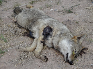 |
| Dead coyote |
 |
| This is the mystery birds - we have no idea what they are |
 |
| Wyoming steer!!! |
 |
| Bridge over Hoback Creek |
 |
| Hoback Creek |
 |
| Little cabin in the middle of nowhere |
 |
| Dead porcupine! |
 |
| Snow on the mountains |
 |
| Neat sculpture |
 |
| The mountains are getting closer.... |
 |
| Closer.... |
 |
| Pronghorn |
 |
| Is it real or is it fake??? Fake! |
 |
| As Mike was riding along the bike trail that leads into Jackson, there was this guy floating above him! |
 |
| And getting closer |
 |
| And lands in the field next to him! |
 |
| Elk antler arch in Town Square in Jackson, Wyoming |
 |
| Statue in the square |
 |
| These are our birds with yellow heads. |
 |
| Close-up of the bird - pretty cool, huh?! |
 |
| Driving thru Jackson Hole, we saw this cool cloud. |
 |
| Bison just wander around free in Jackson Hole |
 |
| Look at this pretty face! |
 |
| Grand Tetons covered in a haze |
 |
| View from our campsite - sunset behind the Tetons |
 |
| Sitting around the campfire our first night here. |


No comments:
Post a Comment