Mesa to Pitt 2015

Mesa to Pitt 2015
Mesa to OBX

Wednesday, August 28, 2013

Wilbur, Washington to Douglas, Washington Aug 26-27

August 26
On Monday morning we woke up and assessed the damages from the storm, which were worse than we expected. The wind and rain ripped through Wilbur, Washington for about a half a hour, and we knew some tree branches fell in the campground, and we knew one of our slide toppers took a beating. Well, entire trees blew over in town, about a half mile from us, and the entire metal piece that attached the cloth over the slide was ripped out by the screws and blown up on our roof. We thought this was going to be expensive and a major repair problem, but then Bob came along. The owner of the campground came by in his bib overalls, on his golf cart, and helped assess the damage. After discussing options, including driving back to Spokane, calling a repairman from 70 miles away, or just tying it on until we got to Seattle, Bob decided we could fix it. He disappeared in his golf cart, and a half an hour later, was back with two ladders, all kinds of tools that we needed but almost nobody has, and we had at it. Pam went to the hardware store to by some more self tapping aluminum screws, and Bob and I climbed the two ladders and bent metal, put slot A into tab B, drilled, screwed, and did a damn good job, fixing that slide topper better than it was when we bought it. If you know me, you know that Bob was the brains of the operation, and we did in an hour what I thought it was going to take days to get done. Thank you, Bob. You are the man! (This is the same guy who served us dinner at our picnic table last night! )
Bob - the friendliest, most helpful guy!  And his wife was darned nice too! (And a great cook!)

After killing most of the day at the campground, we took off to see the Grand Coulee Dam, which is only 20 miles up the road. It was okay that we got a late start because the dam has a laser show after dark, and the timing would work out well. We were shocked at what we saw when we pulled into the town of Coulee Dam.  There were huge trees down everywhere, power lines were down across the road causing detours, and power was out at the visitors center, portions of roofs were blown off of a restaurant and at the casino, and power was out in Mason City, which is the little town on Indian Reservation property on the downstream side of the dam. 
 If you remember, when we were at the Hoover Dam, the visitor center was closed due to backed up toilets, and now we are at the Grand Coulee, and the power is out. That is crazy considering the the dam produces more power than any dam in the USA. It sends power to the grid in eleven states west of the continental divide, but doesn't power itself. 
We walked around for a while, trying to figure out what to do, because nobody was around but utility workers and roofers. We ended going to the dam tour area to get the scoop on the situation, and we got to take a tour in the dam, and got to ride over the dam in a tour bus, escorted by an armed guard. No one can drive across the dam since the Oklahoma City bombings, and security was intense for us to even get on the bus. Pam couldn't take her purse, and they made me unzip my wallet so they could look inside. There was also the standard metal detector, and Pam had to make funny motions with her arms when she went through. We had a great guide who used to work at Hoover Dam.  She had some great statistics and stories, comparing the two dams (Coulee is WAY bigger and produces WAY more power). By the time the tour was over, there were rumors that the power was coming on, and there would be a laser show, which was in doubt. We got something to eat at a restaurant that had power, and then went to the visitors center, and it was open, with no electricity. We wandered for a while, and the power did come on in time for us to watch a movie, and attend the light show. I found out what a coulee was, which is something that has baffled me all my life. A coulee is French for a canyon. The name Grand Canyon was already taken, and there was a large French influence around here, so the coulee of the Grand Coulee Dam, was the grandest coulee caused by the Missoula Glacier Lake that formed coulees all through this area.

                                                             Laser show on the dam
The laser show was done right on the dam, after they opened the twelve metal gates at the top of the dam to let the trickle turn to whitewater, which was the background for the laser show. The show was educational in nature, talking about the Columbia River, which is what is dammed up here, to form Lake Roosevelt. There was some music, but I didn't learn anything that I hadn't already learned in the visitors center. A little disappointing for me, but it was a huge show, running from one side of the dam to the other, and the dam is a mile wide! We got home late, hit the sack, and were out pretty quick.

Lake Roosevelt behind the dam

Grand Coulee Dam

Panoramic picture

Carved statue in Mason City


Power lines running up the mountain from dam

On top of the dam - used to be a road that visitors could drive on

Standing on top of the dam looking down.  White stripes are water streams running down the down.

Columbia River 

Road blocked due to power lines torn down by storms


That would be rocks falling down the mountain!

Laser show on dam

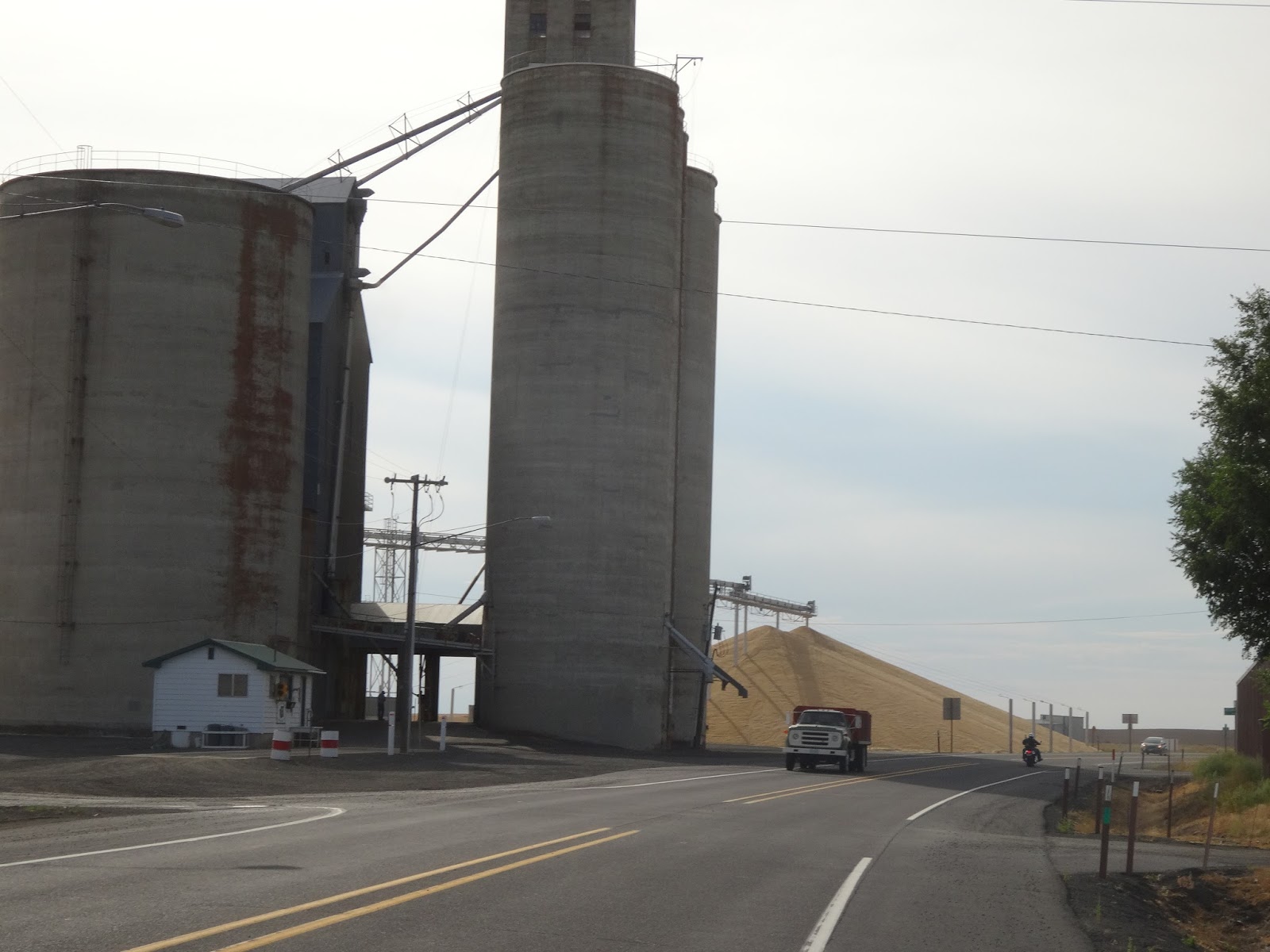
Aug 27 - 67.87 miles in 5:54. I got out the door and hit US 2, with the typical beautiful conditions, 70's with no wind. Nor was there any traffic. It was very calm, riding through 25 miles of wheat fields as far as I could see. Most of the grain is now harvested, and the farmers seem to be turning the crop under. This is a good time of year to be riding through this country, because at least I get to see some tractors and combines out in the field. I usually just see a line of dust rising up into the sky, and if I look a little harder, I see a machine, or maybe it is just a dust devil, kicking up a mini tornado of dust. 
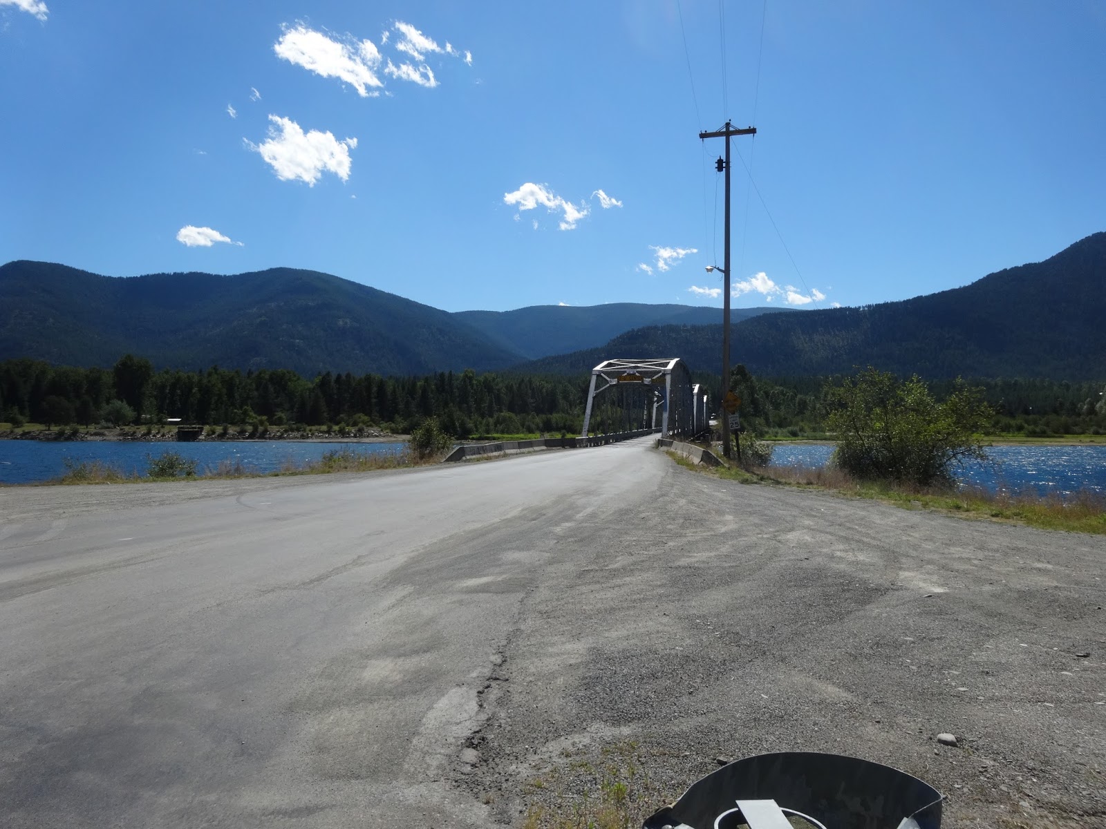
After about 25 miles, I descended into a coulee ( canyon), and came to the small farm town of Coulee City. There wasn't much there, but I did  cross a dam that was holding Banks Lake. That is a lake that is 27 miles long, and it is pumped uphill, out of Lake Roosevelt, by the Grand Coulee Dam complex. The original purpose of the Coulee Dam was for irrigation, not hydroelectric power, and this lake is used only for irrigation and recreation. After crossing the bridge, I had a 900 ft ascent, out of the coulee, and into the 'scablands' of Washington. That is what they call the unfarmable lava rock laden land caused by the volcanoes of the Pacific Rim of Fire. I guess there are 160 active volcanoes from here, through Oregon and California, and in the Pacific Ocean to Hawaii. Some of the land is barely good for anything except some grazing because of the lava of ancient eruptions. That is what they call the scablands, and they are mixed right in with the good fertile land sometimes. After about twenty miles of riding on this boring topography, I descended 850 ft into another coulee. Up until this point I had rough road conditions with expansion cracks in the road, and after 40+ miles of that, my butt and wrists were getting tired of the constant banging. As the wind of the afternoon picked up, at least the road was made of newer pavement down in this coulee. After a few miles, it was another 900 ft ascent, out of the second coulee of the day. I guess you just are not going to get through Washington without crossing these things. They are caused by prehistoric glacier lake floods as ice melted and let loose, and they were floods of water thousands of feet deep. They happened every time an ice jam broke, reformed, and then broke again.
At the top of my second coulee of the day, which had cliffs that looked like the Grand Canyon made out of lava walls, I traveled through more farmland, until I came to another huge descent. At the bottom of my steepest downhill of the day, there came a little town of about  ten houses, and there was Pam, parked in an RV park of about  ten sights, of beautifully manicured grass. There was a general store in front, but it was now a private residence of the campground owners, and it was filled with antiques, including an original soda fountain bar. It no longer sold anything. We spent a quiet evening watching TV and blogging, as not much really goes on out here in the farmlands.


These are plows that turn under the old wheat


Dust devils!

Combines!  They grow them big out here!

Farmer plowing his fields near the silos


Mead(Spokane), Washington to Wilbur, Washington Aug 25

80.77 in 6:30.    Sunday morning is the perfect time to bike through a large city, in my experience on this adventure. Spokane is a metro area of about 215,000, so it qualifies as a big place, especially in this area.  After things dried out a little after some overnight rain, I rode the final ten miles down US 2 on what is called Division Street. As I got closer to town, there were 'no bikes' signs on the road, so I had to start doing some exploring, and I followed some smaller streets into Riverside Park. Spokane was home to the World's Fair in 1974, and their downtown area contains a 100 acre park, where the fair was held. It was a interesting place because it was a park just filled with random walking trails, and amenities left over from the worlds fair. There were some merry go round and midway type rides, mixed with old pavilions and new development. The Spokane River flowed right through the middle of the park, and it had long, cascading waterfalls, dams, and a small hydroelectric power plant. There was a tram that you could ride over part of the park as well as over the river and falls. It made for an interesting place that was quiet enough on a Sunday morning that I could buzz around and check it all out without crowds of people. After cruising the park, I rode some city streets, and found Gonzaga University, surrounded by three other college campuses including branches of Eastern Washington U. and Washington State U. I rode through the campuses, which were built for foot travel only, as there were no roads through them, just around them. Gonzaga is a beautiful place with tons of grass spaces, and no cars anywhere to be found. College kids were just beginning to come back for fall session, so there weren't many people around on a Sunday morning. After about a hour of cruising the town, I had to find a way to get to US 2 West, without getting on  I-90, which ran just south of all that I have described. I took some educated guesses along with a very general map I had been using, and rode up 'two mile hill', out of the Spokane Valley. When I got to the top of the hill, I went past the airport and  Fairchild Air Force base. There was a long business- filled road that reminded me of Rt 19 in Pittsburgh. When I got out of that area, I went into about a twenty mile stretch of the most mind numbingly beautiful wheat fields, and just rolled through the fields on a great, eight foot shoulder on US  2. Once again, there was significant traffic, but absolutely no trucks, and no wind. I was very lucky to hit such a wide open space, with no wind. I made great time, hit a few small farming towns, and just looked in all directions at the endless wheat fields. After about an hour and a half of wheat, the land became rocky and unfarmable, but some cattle ranches were thrown in amongst the sagebrush and useless land. After two hours of that, I was getting very bored with the state of Washington, as I have seen it so far. Pam found a campground in a little town called Wilbur. Like the others along the way, the most prominent building in the town was a grain silo, or two. The campground was a treat though, as the owner delivered a home cooked meal to our camp site! They called it campground catering. I had chicken and dumplings and Pam had a ham steak, with peach cobbler and ice cream for desert. Later he came back in his golf cart, and cleaned up the dishes! All for no more than a meal in a restaurant. We then took a walk around the town, which took about a half hour. Right as we got back, it started to rain, and what followed was the nastiest storm we have been in on this trip. A sixty mile an hour wind kicked up suddenly and lasted for about  half an hour. We closed the slides on the RV, and just sat there and watched the lightning and rocked back and forth.  The wind also took the slide topper (awning type thing) off the slide and landed on the roof)

Water falls in Spokane


The bike is thinking about going to college!

Statue of a monk on the Gonzaga campus

Wheat fields as far as the eye can see!


Panoramic picture of the endless wheat fields

Grain silos with piles of wheat!

Wheat


Tuesday, August 27, 2013

Sand Point, Idaho to Mead, Washington ( a northern suburb of Spokane) Aug 24

70 miles in 5:25. August 24 -----(Aug. 23 isn't missing, we just didn't do ANYTHING. It was a total veggie day, as we sat around while they finished working on the slide seal on RV. We did see a guy have a medical emergency while we were having a beer at the Laughing Dog Brewery, which closed at 8 pm on a Friday night, by the way.) We were drinking Huckleberry Cream Ale!


Okay---the ride out of Sand Point started sort of late, because I was still sleeping off my 100 mile ride from two days before. I had mentioned in a previous post that Idaho was not a bike friendly place, but as  I rode out of Sand Point on US 2, I picked up a bike trail that went about ten miles to the next town, and it kept me off of a road without shoulders. As soon as the trail ended, US 2 became very nice, with wide shoulders, and it followed the Pend Oreille ( pronounced Pondoray) River, until it met the Priest River, pretty close to the state line. Both of these rivers were lined with lake side properties, boat docks, and recreational facilities. There was yet another small dam right before the state line, the Albeni  Falls dam. I took a little time and checked that out. All this takes me back to the other day when I mentioned about the undeveloped riverfront property that I was riding near. It seems that there is just so much riverfront property around here that there is not enough people to inhabit it, therefore, it stays undeveloped. I think that is great. I also learned recently that Idaho has more miles of river and lakefront than any other state of the union. Who would have guessed that!
     After I went through the town of Priest River, I soon hit the Washington state line near the town of  Newport. I didn't see a sign welcoming me to Washington, which was disappointing, but I was distracted by a large crowd in a strip mall parking lot, and I heard a loud speaker. It turned out to be lawn mower races in the parking lot of the Ben Franklin store. I couldn't resist, so I pulled into the parking lot and watched the fun for a while. Once I left Newport, US 2 basically turned very interstate-like. It became very sterile and unscenic, except for one nice area around Diamond Lake. I spent as much time watching for broken glass and tire retread blowouts as I did looking around.  There was plenty of traffic on US 2, but absolutely no truck traffic on a Saturday. The shoulders were eight feet wide almost all the way to our campground, where the northern suburbs really start. I dropped quite a bit of elevation and had a cooperative wind, so I made good time on this trip, and my legs felt really good. Seventy miles flew by, and I wasn't  really ready to stop when it was time, but it was getting to be Saturday evening, and I don't like riding during times when people are more likely to have had drinks.


Lawn mower races!


Sunday, August 25, 2013

Viewing problems with Yellowstone Videos

My neighbor, Cyndi, just informed me that she couldn't view some of the Yellowstone videos.  I guess they said they were private.  That was my mistake when I created the you tube videos.  I have now fixed the videos (made them public) so you should now be able to view them!

Cyndi, you are the best!  The you tube thing is something new that I'm experimenting with, so that I can publish Mike's longer videos.  Thanks for giving me feedback if something is or isn't working.

Friday, August 23, 2013

Oh! Canada....My home and native land...... Aug 22

August 22-----100.82 in 8:30.   How in the hell did my Atlantic to Pacific tour, turn into a Mexico to Canada tour? As soon as I waded across the Rio Grande into Mexico, the seed started to grow. Today it came to fruition. We were only 62 miles from Canada, and we were stuck just sitting in Sand Point waiting for the RV to get finished. I was going to do it anyhow, so today was the perfect day. I got a late start,  because it was cold out (in the fifties), and it looked like it was going to rain. I headed north on US 95/US2, and the first ten miles were brand new asphalt, so I was loving the great road and smooth surface. After that, the road got skinnier and rougher, and the poor road continued all the way to Canada. Idaho is just not a bicycle friendly state. Any place there was a shoulder, it had those foot wide rumble strips in them, which is great for sleepy drivers, but is terrible for bikes. I went through one town of about 2000 people, Bonners Ferry, and the road was worse there than in the country areas. It was about thirty miles into the ride, and I stopped  there and ate at Subway. There was lots of farms on the route, and they were all harvesting their grain or hay, so things were busy. Logging trucks were also flying by in both directions. This is one of the very few ways to get into Canada in this mountainous region, so all truck traffic, and camper traffic, kept me alert on the narrow road. As I got closer to Canada, the road became more desolate, with forests and mountains replacing farms. I climbed over 4000 ft again, with three significant climbs, amongst the rollers, but I also descended over 4000 ft, so it was up and down some.
When I got to the border, I went past the US border, but I didn't actually go through Canada's border station. I took my picture, and went back to the US border station, a way that I shouldn't have, I guess,because I got their attention, and as I parked by bike, I was approached by a US border agent, and she questioned me, gave me hell, and checked my ID.  The border stations were between two steep mountains, and it was a very isolated crossing, unlike what the eastern border crossings are like.  After a quick snack and water refill, I turned around, with my Mexico-Canada tour completed. I retraced my pedals, and before long I realized I wasn't going to make it back home before dark. I called Pam, who was dealing with the RV people and putting pictures onto the blog all day, and after making it back through Bonners Ferry, Pam and the Jeep found me right before dark, and right after riding a century, my second in two weeks. We stopped at Kentucky Fried Chicken on the way home, and I feasted on the greasy calories, but it was GREAT! Now, back to the Atlantic to Pacific thing!


Mike was going to try and take some more pictures at the ranch, but a big, lovely dog came out to greet him, so he moved on!

Another mountain goat!!

Smoky haze in the valley from Idaho forest fires


The bike makes it to Canada!


Who would shave their llama like this??!!

Clark Fork to Sand Point, Idaho Aug 20-21

August 20 ----32.28 in 2:49  we hated to leave the great campsite that we had at the River Delta, but we needed to get to a town that had some services, so we could get some things done.  It was just the right amount of distance to get in a little ride, and still not beat my legs real bad, because they are a little tired, and a day off may be in order in Sandpoint. Idaho.  Rt. 200 is definitely more narrow that its counterpart in Montana, but traffic wasn't terrible. The Clark Fork River, once again slowed in flow, so I thought another dam was downstream, but that wasn't the case. I lost the river for a short time, but when I came over the crest of a hill, I saw a amazing sight. The river had flowed into the Lake Pend Orielle, a huge lake that looked like someone put an ocean right down in between all the mountains at 2000 ft of elevation. NOW, I know why there was such little development upstream! There were marinas, resorts, sea planes with pontoons on them circling overhead, and all the makings of a vacation heaven. Even though I had never heard of this place, Lake Pend Orielle is the fifth largest lake in the US. It is 43 miles long and has 111 miles of shoreline. It is not caused by a dam, but a natural glacier 'ditch.' The town of Sand Point was voted by some big magazine as the most beautiful small town in the USA. It has a huge, natural, sandy beach in town, a marina, walking trails along the lake, and the worlds longest retail bridge. It's a bridge about 400 yards long that is covered by a building and has stores inside. Not chain stores, but local craft stores and the such.
As it turns out, the county fair is also going on, and once again, there were zero camping sites available in the few campgrounds in town. One of the campgrounds was the county fair site, so that wasn't going to work! The people at the campground that Pam ended up at were very cooperative, however, and we got a place to park and plug in at their RV repair shop. While we are here, it only made sense to have the shop look at a couple of things that need repaired on our RV.  A seal has come loose on a slide, our built in dust removal vacuum vent (I know, we are really roughing it), and a few other little things need done. 
 I am only 50 miles from Canada, so I am going to take a day and ride up there, while we are based in Sand Point. We may go to the fair, the beach, and just hang out for a few days. After I got into town, Pam and I Jeeped into the downtown area and had dinner, and walked around the town. It felt like we were in a beach town on the east coast, only without the humidity. I think many of the tourists are from the Spokane, Washington area, and from Canada. As nice as it is, it still is never going to be avoided because of the crowds. There was just a comfortable amount of people strolling the streets, prices were reasonable, and we have discovered another gem in the west.

August 21----- Here we took a day to enjoy Sand Point and get some work done on the motor home at Lake Rv, where we are staying. We went to City Park, which  is an island surrounded by Lake Pend Orielle. There is actually sand that occurs naturally here, its just a little more coarse that at the ocean. The park also includes a marina for motor boats, one for sail boats, tennis courts, sand volleyball, picnic area, open grass spaces, and the whole beach scene is surrounded by huge, beautiful mountains. The swimming beaches are life guarded, and the area is huge, for the few people that come here. In the evening, we went to the Bonner County Fair, paid a whopping 3 bucks (for the 2 of us) to get in, and walked around looking at chickens, pigs, cows, and 4-H projects.

Lake Pend Orielle


Marina

Sea Plane

Wild Horse Plains, Montana to Clark Fork, Idaho Aug 19

August 19.     - 82.36 in 7:33.     In general terms, today was a day of rolling hills. The elevation never really changed, as the Clark's Fork River is dammed up by two hydroelectric dams, but I climbed  over 2600 ft of rollers, and descended 2700.
 I started out the morning in perfect conditions, and followed the river until the mountains narrowed in on me, and the road lost its shoulder, and was abutted by rocks on my right. A roadside plaque said that this was the Bad Rock Trail, and it was a very rough area. Big horn sheep warning signs started to appear, and as I looked to my right, I could see the sheer cliffs that they like to roam. I saw four bighorns along the road just before Thompsons Falls, and Pam saw a big one very near the road as she was driving. When I stopped to read the plaque about the Bad Rock Trail, I got into some gravel, and couldn't get my foot unclipped from my pedal before I tipped it to the right, and landed pretty hard. When my shoulder hit the ground, my head snapped real hard and smacked off the ground also. My helmets outer decorative shell broke, but the helmet did it's job and saved my pumpkin. My sunglasses somehow cut the bridge of my nose, but the most notable result of the tip over, was a fantastic chiropractic treatment on my neck when it snapped off the ground. My neck really bothers me when I'm straining into a headwind, and I have been doing that for a few days now, so the relief was welcomed, and I didn't even have to show my Blue Cross card! 
After about twelve miles of narrow roads, I came back to the rivers edge, only now it wasn't flowing like it had been. I knew there was a dam downstream, and the back up had begun. I was happy to be off the narrow part of the road, because traffic, especially trucks, picked up significantly on this Monday. Yesterday was Sunday, and traffic was significantly less. Today, every worker with a pick up and a trailer was flying by. No problems, but people around here just drive really fast on the curvy roads. I have been noticing large amounts of dead deer, and even more deer skeletons every where, and that also is a result of high speed travel on these roads.
      I finally came to a tourist town, Thompson Falls, about 25 miles into the ride, and the development that I noticed was missing yesterday, began.  I grabbed a quick lunch at the Subway there, and was on my way through rolling ponderosa pine forests with huge cedar trees mixed in. As a result of the development, all the riverfront (lakefront) property, was filled with homes, camps, and ranches, and the road veered away from the water for quite a while. Somewhere in the forest, the afternoon wind began to fire up and smack me in the face again, so that slowed progress.  There was a lot of logging and rock quarry work in the area, including the biggest logging mill I've ever seen. I have noticed that they don't waste a tree here in Montana. Most forests I've ridden through have lots of fallen timber on the ground, but there is very little downed timber here. Everyone has massive supplies of firewood around there homes, and I think they are allowed to forage through the forests for it. In some states, they don't let people clean up the dead wood, and it just lays there and waits to be fuel in the next forest fire. In Montana, they keep there forests clean. They also harvest a lot of commercial timber, and the forests are not nearly as dense here. 
As I came eventually back to the water, I saw a sign for the Noxon Rapids dam, so I went a few miles down a side road to see that. After the dam, the river took on its previous flow, until a few miles went by, and I noticed that the river was widening and slowing again. As it turns out, the dam I saw was Montana's hydroelectric dam, and the water was backing up again, because as soon as the river gets into Idaho, they have a dam too. For all the recreational opportunities I've been seeing, and even with increasing development, there still aren't many people around these parts. Another thing I noticed was that  everything is for sale! Everyone has a for sale sign on their house, their property, their old truck, their antique tractor, anything. I did see a beautiful ranch for sale with a log home and 50 acres for under a half million. That same half million could get you half an acre and one of the cheaper houses in Southpointe, where I made my living. If you want to spread out a little, Montana is the place to be! Less than a million people live in this huge state, and they like their isolated homes.
     I finally crossed over into Idaho, and the roads deteriorated significantly. The shoulder disappeared on the road, and they became 'Texas Chipseal', which I hated so much. Fortunately, the roads are so worn that the roughness is gone, but I see more potholes than I have seen anywhere since Pennsylvania. Pam found a campground five miles into our new Pacific time zone, so its going to get dark an hour earlier for us now. The place we stayed is a 'resort' of privately owned sites, and it was pretty wiped out from a flood a few years ago. We got a site that was hard for Pam to get into, but we were right on the Clark Fork River. A beautiful, private place with no one else around. I celebrated being in Idaho by eating a baked potato for supper, and spent the evening watching the Steeler preseason game, which ended early enough for us to sit outside with binoculars and a camera, and watch the near full moon come over the mountains while the sun was still shining, and watch for wildlife along the river banks. Another really, really, nice place. 'The road goes on forever, and the party never ends! '


Bighorn sheep

Lumber mill 

There's a lot of logs here!

Yup!  Their welcome sign is on a little island in the water!

Moose antlers on the ranch entrance

You do see some weird things on the road!  Like this mannequin in a bikini!

Another Montana white cross


Noxon Dam


Our campsite overlooking the river

Isn't it lovely?

Mike was experimenting with full moon pictures - here are two of them


The Wampus Cats????!