Mesa to Pitt 2015

Mesa to Pitt 2015
Mesa to OBX

Thursday, April 30, 2015

April 30...Iola, Kansas to El Dorado Springs, Missouri

79.24 miles in 8:22...ascent...1742 ft...descent...1795 ft...average speed....9.5 mph....max speed....23.7.... Total trip miles...1309.81....trip ascent....29,290...average milage per day...72.77 miles

I got out the door early today, because the wind was going to be out of the northeast, which was the direction I was traveling, of course. It wasn't supposed to be strong, but it was going to be a factor. The other factor was that my legs are a little tired, and that is a bad combination. It was about 50 miles to the Missouri state line, and I was looking forward to crossing that, but Kansas was starting to get a little more serious with their rollers as I get east. I would say that at least two of the rollers in Kansas qualified as real hills, and there was going to be a lot more of them in Missouri. Kansas stayed true to its character for those fifty miles, grasslands, cornfields, cattle grazing, plenty of small streams and rivers I've never heard of. Fort Scott was the largest town I would go through in Kansas today, but US54 missed most of it. I think I just caught the east end of town, and I stopped at a convenience store and bought an ice cream bar, refilled ice, and stripped down a layer, because the weather warmed up nicely by noon, to almost 80. I left Kansas with a serious climb out of Ft" Scott, and Missouri met me with a hillier topography, and a reduced wind, because there were more and more trees. Twenty miles into Missouri i bypassed a town of 12,000, Nevada, pronounced ne vay da, where I had considered staying for the night. High school had just let out, so traffic was sort of heavy, and the spring hormones were flowing, as I had cars honking, passengers screaming out the window, people burning rubber at stop lights, and generally just stuff I'm not used to on this trip. I decided to put down another 20 miles, and got to El Dorado, pronounced dor ray do, where I knew there was only one motel in town. US54 had times of nice shoulder today, and times of narrow shoulder, especially in parts of Missouri, where there were some real rough spots. I've been spoiled by 54, but tomorrow will be the day I leave it for the first time since Tucumcari, New Mexico. When I got to the motel, there was a McDonald's closeby, but I just couldn't do McDonald's again. I went to Dollar General and bought two cans of chef boy ar di ravioli, a container of cottage cheese, and a bag of Cheetos for supper. Sounds appetizing, huh? Fuel for the road takes strange shapes when you are me.

A wounded hawk that would not pose for the camper

The highly anticipated Missouri state line

times 2!

The Tin Man from Kansas waving goodbye!

More yellow fields

The Missouri flag

A typical Kansas farm town


Wednesday, April 29, 2015

April 29...El Dorado, Kansas to Iola, Kansas

85.09 miles in 7:33...ascent....1325 ft.....descent....1686 ft...average speed....11.3 mph....max speed....25.3 mph...total trip miles...1230.57 miles....total ascent....27,548 ft....average mileage per day... 72.39 miles a day
I didn't even wake up until 8:30... Catherine and Cecil were long gone to work. They showed me how they wanted me to lock up, and I was out the door at 9:30. The weather is on a gradual warming trend, and it was in the mid fifties by the time I rolled. It got into the seventies as the day went on, perfect riding weather. The wind was mostly out of the north, as side wind that could be pesky at times, but generally I was very happy to get through the wide open spaces that I rode through without a headwind. When a truck would go by, it changed wind currents, and really blew me around today. With the narrow shoulders, I really had to hang on and steer a couple of times. Even more so than usual. I rode through miles and miles of grasslands, rolling more than most of Kansas, but not hilly. I crossed many rivers, many creeks, and there was always a lake or pond or watering hole in my sight. So I am no longer in a drought warning area, I would say. It took me this long to get to an area that seemingly has enough water. There were usually range cattle somewhere in my line of sight, and there were many oil rigs out in the distance. I was told by my host last night that this area provided most of the oil that the USA used to win WW1. US 54 has changed quite a bit on the east side of Witchita. 99% of the truck traffic filtered onto the Kansas Turnpike, aka Interstate 35. The shoulder reflected this lack of traffic by reducing its width from the 6-8 ft I've become accustomed to, to more like 2-4 ft. Traffic is so much more sparse that it was seldom an issue. 
I was on a section of the Adventure Cycling Assn. Trans America route that runs from Yorktown, VA to Astoria, Oregon. I discovered this when I passed a man from the Netherlands named John that was soloing to san Fransisco. A few miles later, I ran across two University of Texas students, John and Steven, who were doing the coast to coast for cerebral palsy, trying to raise $30,000 for an acquaintance.. They said they came from a town called Chardon,  a little further south, not on US 54. I found out why they came that way as I rode a little further down the road to Yates Center. I stopped at a convenience store to get ice, and to find out about the 'road closed' and detour signs on US54. It turns out that 54 was closed to rebuild a bridge over some train tracks. The detour was taking people through Chardon, fifty miles out of the way. Well, that wasn't going to happen. I asked a local what the best plan might be, and he told me to go right down to the construction, make a right onto the gravel road, go one mile, make a left on another gravel road, go one mile and make another left, back to 54. I was concerned about that, but it was better than going 50 miles out of the way. I also thought I might be able to sneak through the construction zone, like I've been known to do. I found out that wasn't going to happen, so I took the gravel roads, and it worked out pretty well. It was washboard hardback, pretty dusty, but I just followed traffic and found my way easily. About two miles out of the way. Better to be lucky than good. When in doubt, ask a local! The last 20 miles of the ride were great because there were no trucks, and very minimal traffic all the way to Iola (I-O-la). I pulled into town about six, talked an Indian down ten bucks at the Heritage Inn, walked around town a little, ate at McDonald's ( again!) and plotted my next few days of travel.

Oil rig museum in El Dorado, KS

Corn fields with 4 inch stalks growing

There are still "roadside rests" to have a picnic

A scenic river and waterfall

Ponds were becoming a very common sight

Steven and John heading to Oregon

Plaque explaining usage of the grasslands

Detour on US 54 wasn't as big a headache as I anticipated

My gravel detour road

Welcome sign in Iola, KS


Tuesday, April 28, 2015

April 28....Bicycling from Kingman, KS to El Dorado, KS

83.3 miles in 7:55....elevation climbed...1401 ft....descent...1293 ft. Max speed 18.9...average speed 10.5 mph..., total trip miles....1145.48.....total ascent....26,223 ft.
I woke up raring to go, but I failed to do one thing that I always do. Whenever I get up, before I even pee, I feel my bike tires to make sure I don't have a flat. I read that in a cycling blog somewhere. Well,this morning I forgot to check, got all my panniers loaded up, locked myself out of my room, got on my bike, and had a flat front tire. CRAP! I got the housekeeping lady to let me back in the room, unloaded the bike and fixed the flat. The first tube I tried had a hole in it. The second one worked, but what a pain in the butt. The whole process wasted about a half an hour, but it was still good that I got flat in the room, and not out on the wind blown plains of Kansas. 
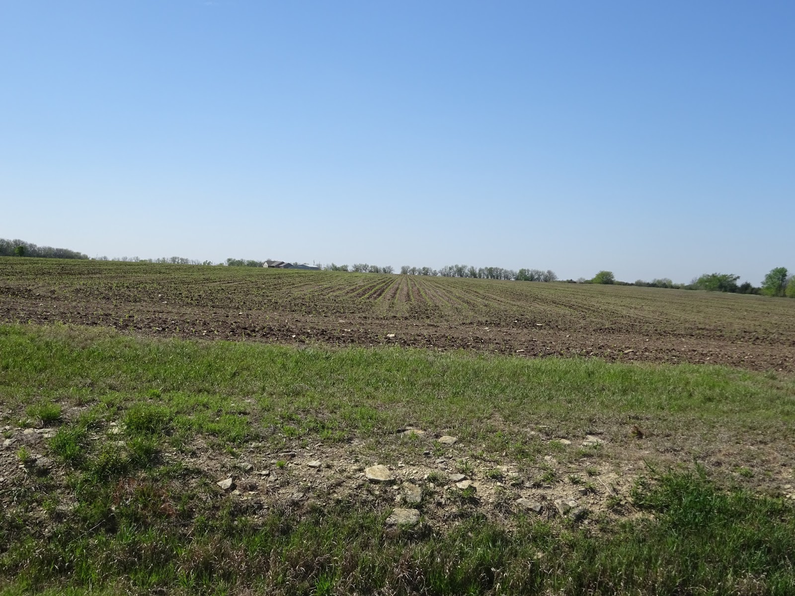
The wind was behaving itself way more than it was predicted, so I took advantage of a neutral wind and ever warming temperatures to have a great ride. The day off also worked miracles for my legs. I'm still wondering in my mind, whether tired legs or big winds were holding me back more. It was about 17 miles into the trip, when GPS girl pulled me off US 54, for the first time since New Mexico. I went north for about four miles on 391st street, which brought me to 21st street, where I turned right onto the road that would take me most of the way through Witchita. US 54's nice shoulder was acting as a drag strip for me, so I was sad to pull off, but 21st street was even better! Smooth tar with no chips, and the rolling miles went by nicely. Today was the first day I climbed more than descended since I was in Albuquerque, ten days ago. It's definitely rolling more, and there are more trees to break up the wind some. The time spent on the west side of Witchita was in farm land, but the east side had more oil rigs than I've seen since I was in Oklahoma last year. Witchita itself was dotted with many lakes, and I crossed the Arkansas River. I didn't go through downtown Witchita, but my path of travel took me through the northern suburbs, most of which were affluent and nice. While I was near town, I stopped at a Specialized bike shop and bought a new back up tire, since my front one seems about cooked all the sudden, and I picked up a new thorn resistant tube to replenish my stock. I feel better having a safety net, too many tubes and tires, rather than not enough. The small search for the bike shop took me out of the way slightly, but not really much, and it was definitely worth it, because who knows when I could find another bike shop so convenient to where I was traveling. In that regard, Witchita came by at just the right time. The east end of the city on 21st street, took me through an industrial area, with crappy roads, and then I started heading north, on some neighborhood bike trails and side streets to get me north to KS 254, which would take me to my final destination of El Dorado. I noticed that Witchita had absolutely zero bike lanes on their roads, but they seemed to have a decent trail system, including along the 20 mile stretch of 21st Street that I rode. A sidewalk on one side of the street was wider than a normal sidewalk, and doubled as a multiuse path, including underpasses for crossing the busy road. I don't know how their bike lane system is downtown, or around Witchita State U, two places I would have liked to see.
After popping out on KS 254, I had another 25 miles to travel on this four lane highway to get to El Dorado. This is where the smell of crude oil rigs outdid the smell of fresh country farm air. The wind picked up a little in the late afternoon, or was it just my legs getting tired? I pulled into El Dorado, a town of about 12,000, and stopped to google for cheap motels. I found one for $42, but it was off the main drag, and as I was riding some side roads, a couple, about my age waved me down from their SUV. They asked me if I needed a place to stay tonight, and offered a room at their home. When these things occur, you are never sure what you are getting into, but their SUV was very nice, and so were they, so I bit. They guided me to their home, and much to my surprise, it was in a beautiful golf course community very similar to Ironwood in Sourhpointe. My room and private bath were as beautiful as their entire home. I got a shower, and we went out to eat at a sports bar called Willie's. We chatted quite a bit, and they were very interested in the concept of Workamping, which they were not that familiar with. After arguing about the check, they even bought my meal. They said they were envious of cross country bicyclists, and had hosted some in the past, but not many pass this way. They have hosted several foreign exchange students also. Cecil is an IRS agent, and Catherine works for the Vornado company, a type of house fan that circulates air in a unique way. Very, very nice people.  These are the kind of people that I've always heard about meeting when you travel as I am, road angels, they are called. I questioned their trust of perfect strangers, but they really just think it's something they enjoy doing. This is what enamours me to the Midwest. The further you get from either ocean, the nicer people seem to be to strangers. Just things like saying hello and trusting your fellow man. I'm laying in a comfortable bed, typing this blog, in a perfect strangers house. How cool. And they will both be gone for work in the morning when I get up.

Notice the yellow field in the background

Kansas state roads are denoted by sunflowers

Cecil and Catherine

My bed for the night!


Sunday, April 26, 2015

April 26....Pratt, Kansas to Kingman, Kansas

36.75 miles in 5:30(yea, you read that right)....elevation gain....558 ft. Descent....925 ft....average speed....6.7 mph...max speed...13.0 mph...total trip miles1062.18.....total elevation gain....24,822ft .....average miles per day over 15 consecutive days....70.812 miles a day
I thought my biggest problems today we're going to be the headwind (10-20 mph), and the cold temps. Well, the temperature started out at 43, and barely broke fifty while I was riding, but that wasn't a problem. I've been packing around all these weather clothes, and I finally got to use them, including my booties that I managed to make fit over my sandals. My panniers were very light, because I was wearing everything. Well, almost. I really hope I don't have to ride with everything I have, but aside from being a little wind chilled, I was fine temperature wise. The wind certainly sucked, but even in times of reduced gusts, or rolling down the mild  downgrades I encountered, I realized my biggest problem was my legs. They totally imploded after yesterday's 93 mile ride, and there is nothing left in them to give. Fortunately, tomorrow is going to be the worst weather day that I've encountered on this trip. A perfect day to take a day off, and try to rest my legs, in preparation for the rest of the trip. According to my GPS,  I am currently 1,159 miles from Claysville, Pa. That puts me at about the halfway mark after one more day of riding.
Today's ride was one of the most miserable I've ever had, still, the five and a half hours went pretty quick. The effort was the same as any other day, but the results were not. I'm used to riding a lot more than 5 1/2 hrs a day, so that part was tolerable. I only climbed about 550 ft, which is one of the flattest days ever, but each little climb felt like a mountain. Since just west of Pratt yesterday, the landscape of Kansas has started to change, going from flat farmland to a topography that rolls more, and instead of farmland, I saw more cattle ranching, and a pretty large wildlife and waterfowl conservation area. The Ninnescah River, a smallish stream, was responsible for most of my climbing, as I crossed it five times, each with a downgrade and an upgrade. The heavy gray clouds sometimes dropped some mist on me, but the day remained dry. That may not be the case tomorrow, but it will be a rest day just the same. 
The day ended with a room at the Çopa Motel on the east side of Kingman, a town more similar to Pratt than all the grain elevator dominated towns of south central Kansas.  Rolling, tree lined streets more than pancake flat streets are becoming more the norm, since I'm getting closer to west Kansas and Missouri.

Saturday, April 25, 2015

April 25....Meade, Kansas to Pratt, Kansas

92.53 miles in 9:14....average speed...10.0 mph...max speed...20.3...elevation gain...666 ft...descent...1280ft...total trip mileage...1025.43 in 14 consecutive days of riding...total elevation gain... 24,264.
My choices today were a 63 mile ride to Greensburg, or 93 mile ride to Pratt. I had a suspicion that today was going to be the best riding day in the next three, so unless there were unforeseen circumstances, I was going for the 93. I left at 9:00am, thinking that if I could average 10 mph I could make Pratt in 9 hours. Anything less, I was going to pull up in Greensburg. The wind was supposed to be mild, for around here, out of the NNW, which would make it a side wind with maybe a little push for me. Well, that's exactly how it played out. I was right about 10 mph the entire trip, so I went for the long ride. It was a beautiful day, even though it started out a little chilly, about 50 degrees. Everything was fertilized green, the sky was blue, and it was a pleasant ride for the most part. I passed towns about every every ten miles across the entire stretch, some being only grain elevators with a few side businesses, others being real towns with "Main Street"s off to one side or the other. There wasn't much too look at unless you like looking at grain elevators that are eight miles away, and slowly watching them get closer. Highlights included watching a single prop plane put on an "air show" for me but generally swooping around over the alfalfa fields, near irrigation rigs and wind farms, for about a half an hour. One town of note was Greensburg, which was totally destroyed by a tornado sometime around 2008. I saw a feature on it last night on a Wichita TV station, where I saw video of the aftermath. Today was a big day there, because they were opening a movie theater, which would complete the comeback. When I rode through town, I made sure to check out the brand new "Main Street" area, and it was pretty cool, after seeing what the tornado did. The population of the town is about half, but the comeback is complete.
Yesterday I rode 80 miles in six hours with a tailwind. Today, with a neutral wind, I did 80 in 8 hours on my way to 93. It just goes to truly demonstrate that the wind can made hours worth of difference in a days ride, not minutes. The wind is my hormone right now. It makes all the difference in how my day goes, how I feel, my mood, and my outlook on life for each day. It's totally out of my control and I just have to deal with it, for better or for worse. 
My day ended at a Motel 6 on the outskirts of Pratt, so I never really got into town. I did walk to the corner grocery store and picked up some lunch meat, buns, and mixed fruit for supper.

The plane that put on an "air show" for me by swooping around the wind turbines and over the fields.  I watched him for a half hour!

Scenery included wind farms and irrigation rigs... 

and grain elevators.  You could see them from about 8-9 miles away!

I didn't heed this warning!

Tons of hay rolls. 


Friday, April 24, 2015

April 24...Guymon, OK to Meade, Kansas

80.92 miles in 6:00 hrs...860 ft ascent....1447 descent....average speed...13.5 mph...max speed 34.7 mph....total trip miles....
The Hispanic guy at the tire shop a few blocks down from the motel got me all fixed up with his pump and pressure gauge, but I didn't stop by until after 9 am, so he would be open. I was on the road at about 9:30, dressed for the 80 degree day that we were supposed to have, even though it was in the fifties. The sun was out, the light wind was a tailwind, so all was good. US 54 continues to be just a fantastic road, if you don't mind truck traffic. The shoulder is really wide and smooth and clean in most places, but there are lots of trucks going from I-70 to I -40. I have never seen so many grain trucks, full and empty cattle trucks, organic milk trucks, National Carrier trucks ( which are carrying processed beef), and I was even passed by five double length trucks carrying arms for the windmills on wind farms. I passed through a few small towns, so I never feel like I'm in the middle of no where, and I can almost always see the huge grain silos which are the centerpiece of each town. Every inch of ground was either grass for hay, unplanted corn and wheat fields, fallow fields, or grazing land. There were three huge beef processing plants, in the bigger towns, like Guymon, and Liberal. 
Liberal, was the halfway point of the trip, and I stopped at a Subway for lunch. Made the first 40 miles to get there in under three hours. See what properly inflated tires will do! Just kidding...the tailwind was perfect and I was cruising. It seems weird at first, but the faster I'm going, the less I'm working. It's those days when I'm barely moving at 8 mph that I'm working my butt off! Liberal also has a big tourism thing built around the Wizard of Oz, but none of the characters are exact replicas, so that tells me that they are not associated with Judy Garland and the original movie at all. I snooped around a little because they had Dorothy's house somewhere, but you had to pay to see it. I wanted to get a picture of the old lady who carries Toto away in her bike basket, but didn't see her at all. Oh well.
Once again, just like the other day, fluffy clouds started to turn into dark ominous thunderheads, and they chased me into Meade. This time though, I didn't get wet. It rained after I got into the room. I thought about riding the tailwind to the next town and getting 100 miles in because I had the time before it got dark, but the approaching chase clouds were running me down. There were tornado warnings and actual tornadoes lighting up all of Kansas for a few hours in the evening, but none real close to me. Tomorrow promises to be sunny and tailwindish again, with no rain forecast.
The day finished at the Moon Mist Inn, in a nice room, and a Pizza Hut supper.

A town miles away

What kind of town is this??

Yep, we are in Oklahoma!

4th state in 4 days!

Home of Dorothy from the Wizard of OZ

A new state to my list!

Dorothy and Toto, too!!!!

Statue of Dorothy...

and Toto, too!!!

A huge beef processing plant outside of Liberal

A windmill propeller on US 54

Pretty big, eh?!

The Cimerron River has no water!

Okay, maybe a little water

I beat the storm to Meade, KS


Green fields of Kansas

The storm that chased me into Meade, KS

Thursday, April 23, 2015

April 23.... Bicycling from Dalhart, TX to Guymon, OK

E72.56 miles in under 7:00...elevation climbed...344ft...descent....1194 ft... Maximum speed...22.1
Total trip miles...851.98...total elevation climbed...22,738 ft.
I was awakened very early by housekeeping, and I told them to go away. I woke up at 8:30, but yesterday it was 7:30 because of the time zone change. It was cold, humid, wet and cloudy from last night's rain so I wanted to sleep in and get a later start. The forecast was for the wind to change to a tailwind as the day went on, and the clouds were supposed to break up after noon. 
I felt like I was riding in a relative urban jungle today, passing through three towns before settling into the fourth town I came to. The first 32 miles were cold and cloudy and the wind was just a slight hindrance. The terrain was very flat, US54 was pretty nice, with a great shoulder, and very little chip seal. There were really no scenic highlights, just ranches and farms, irrigation rigs and grain silos. The first town I came to at that 32 mile mark, Stafford, was basically just an intersection, a huge grain storage facility, and a few businesses. There was a Subway, so I stopped for lunch, and watched the clouds start to break up, and I was certain I saw the flags at the Subway showing a tailwind. 
The next town, Texhoma, was twenty miles away, and after stripping down one layer, I enjoyed some sun and a little help from the wind, and passed the time waiting for another train to go by so I could wave and get the engineer to blow his horn at me. At least six trains blew at me, and I saw several more on the train tracks that run parallel to US 54. Texhoma, was another town just like the last, only with a little downtown area off to the left of the main road. The state line, of course, was right in the middle of town, hence Texhoma. The grain storage in town was for wheat, so that must be a big crop that is not in yet. Once in Oklahoma, there were several wind farms of about 15-20 wind turbines each, and also some old school oil rigs, not all cattle and farmland like in Texas. Guymon was only another twenty miles down the road, and there was one more town, between Texhoma and Guymon,  which included OkÅ‚ahoma Panhandle University. US 54 was nice with great shoulders in Oklahoma, the only difference being a median strip, so it was just like an interstate. The grass had also been mowed in the median and along the road, so it seemed less wild than the stretch in Texas. The wind really kicked up on this stretch, and it didn't give me as much of a push as I had hoped. It was a side wind, hitting 25-30 mph on occasion, and it just slowed me down and made it tough to steer. It felt like someone was hanging on to my panniers. The last five miles took forever, because I could see the town, but it seemed like I just wasn't getting closer. I finally pulled into the Pioneer Motel, which is a real craphole by the way, and promptly couldn't get out of my clips before tipping over in the parking lot. Nice. Just a little blood and nothing broken on the bike, fortunately. 
I spent the evening changing my back tire, because I noticed some pretty nasty slices in it when I stopped for a picture back in Texhoma. I had a hard time getting it right, so I'm going to go to a tire shop, or the little bike shop in town, if it's open, to get the tire to seed properly, and get the correct inflation. The little emergency pump that I carry just isn't going to get it right, especially without a pressure gauge. I had two pieces of pizza from a Loves gas station for supper, then found out that the shower didn't work, so I took a washcloth bath for the first time in forever. My progress tomorrow will depend on how long it takes me to get the right tire seed and air pressure in the morning. Can't wait.

I didn't get a chance to go into town because of rain.

A blown over rail car says volumes about the wind!

US 54 is all farming and ranching

These huge grain storage facilities are the center of every town

Big Tex?!  I have no idea why he was across from a silo!

Cattle roamed the range as well as populated feed facilities

Entrance sign to a farm town

Not a bad thing!

One of dozens of dead coyotes that I've seen in Texhoma

Texhoma!

Wheat storage in Texhoma


The state line was in the middle of Texhoma

I would have eaten a steak here if I was staying in town!

Never heard of this University!


Time to change tires!