66.27 miles in 6:36...... Elevation gain...4300 ft......descent...2150 ft.....maximum speed....38.5 mph.....average speed.....10 mph. There is no way you can train to travel with a loaded bike, so you just gave to load up and go, and hope for the best. I bought front wheel panniers for this, my first unsupported trip. I have to carry everything I need in these two front wheel bags, along with the three back bags that I have carried at various times in the past. By design, Pam is staying in Mesa to work one more week, then get some service done on the RV, and she will catch up to me sometime, somewhere, in about ten days. Thus means that for the first time, I'm really crossing the country on my own. If something goes awry, she won't be 59-60 miles away, tops, to bail me out. The bike has to stay healthy, and I have to stay healthy. Today's ride began with me having a cold, the sickest I've been since I retired, but when the gun goes off, you have to answer it, so I left, hoping to recover as I ride, averaging over 70 miles a day, every day, until we meet again.
The bike is really heavy, loaded with tools, spare tire, clothes, especially cold weather and wet weather gear, medicines and toiletries, Sports Illustrateds, of course, the iPad, so I can blog and keep up with the world, and extra space for water, which is heavy, and some food.
There is only one way to get out of the 'Valley of the Sun', no matter which direction, and that is uphill. I designed my course to avoid as many mountainous areas as possible, but you have to climb to get into the rest of the country from the Phoenix metro area. I chose to head southeast, on US 60, to get out of the valley. The first 15 miles were really still in Mesa and the metro area, mostly on Baseline Drive, because US60 is a major highway in the city. The route goes just to the south of the Superstition Mountains, so there were always huge mountains to my left, and pretty flat desert to my right, filled with cholla cactus, and Seguaro cactus, for about the first 33 miles of the trip. From the minute I started pedaling, I was on a sometimes unnoticeable uphill grade. Sometimes it was noticeable, too, but it went on for 33 miles. The sun was out, but it was cool (75-80 degrees), and the ride was quite pleasant. US60 is a busy road, even on a Sunday, because it's the ONLY road going to the south, around the Superstitions, which cover an area approximately 65 miles by 35 miles. If you go north of this range, you must go to higher elevations and through more mountains, some even having snow, hence, US 60 it is. I gained about 1500 ft in those previously mentioned 33 miles, which tenderizes your legs without you really knowing it. Then the fun began. In the next three miles, I gained another 1500 ft. That's a pretty significant hill, if your not paying attention. Then after 36 miles of uphill, I got to go downhill, and rolled for a few miles, to the 44 mile mark for the trip, into the town of Superior, AZ. It's a small, Hispanic looking town that is probably there because of the mining industry. I stopped at a Circle K convenience store and bought some lunch, and refueled. My GPS told me I only had 23 more miles to go to my destination of Globe, but it predicted that it was going to take three and a half hours, when 23 miles should normally take under two hours. This gruesome prediction, told me that I was in for some serious climbing, and I wasn't deceived. US60 out of Superior on a steep grade, and got only steeper. The shoulders that had been reliable, disappeared, as the four lane road twisted and swiveled up through the mountains. It turned out to be a four mile, 7-8% grade, which is brutal, considering most interstates max out at a six percent grade at their steepest. Think steeper than Wheeling Hill in Wheeling, or Lincoln Hill in Washington, for four miles. The scenery was absolutely beautiful, but I only could take pictures when I stopped, and my screaming quads and oxygen debt kept me from thinking about pictures, as I climbed to over 4600 feet. I went through one tunnel, which was about a quarter mile long, and looked at hoodoo shaped rock formations whenever I thought to look up. I stopped about once a mile, and walked about 100 yds each time, just to get my legs back from the brink of failure. It would have been challenging without packing 40-50 lbs, but the weight helped me to understand my limitations, so I wasn't embarrassed to walk short stints. The alternative was to stop and tighten up while standing or leaning on a guard rail.
At the top of the mountain, was a small town called Top of the World, and I rolled, up and down gradual grades, with a cool tailwind helping me along, and clouds that threatened rain, something I haven't seen in a month. Thank God for the prevailing tailwind, and the clouds, for a hot sunny day could have been disastrous. Then the descent finally began, as I dropped about five miles at a rate of 30-35 mph, past a huge copper mine, into the town of Miami, AZ. Miami is pretty much a semi deserted town that looked like it had its typical boom, with the copper mine, and then faded as the mine tapped out. Miami lead into Claypool, which lead into Globe, as the mines were visible for the entire final six miles of my ride. Claypool and Globe look a little better off than Miami, but these towns almost certainly exist just because of copper mines and the mineral industry. The area reminds me in many ways of a West Virginia coal mining town. The cactus were long gone, because of the elevation, and I even saw a black mountain that I would swear is a slag dump from a coal mine.
I eased into the Bell Aire Motel, to crash into my $40 room. No luxury, the room was clean, but old, the shower felt good, and the TV, and fridge worked. There was free wifi, which I used to type this, so I was very happy with my accommodations. I walked about a mile and had a great Italian lasagna dinner and a beer, before crawling into bed, hoping that my legs will somehow function, with my 50 lbs of ballast tomorrow.
 |
| Loading up the bike to start his journey |
 |
| Time to mount up! |
 |
| Posing for goodbye picture! |
 |
| Just showing how he's loaded up - even carrying an extra tire on the back |
 |
| Leaving Towerpoint |
 |
| Goodbye sweetie! Safe travels! |
 |
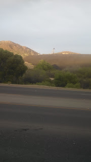
| Roadrunner made of rocks as I entered US60, the Superstition Mountains are in the background |
 |
| Cholla cactus and mountains line US60 |
 |
| Nice shoulder with a gradual uphill grade into the mountains |
 |
| Sign as I descended into Superior |
 |
| The tunnel and beautiful mountains as I climbed on US60 |
 |
| Looking back after I survived the tunnel and walked for a short while! |
 |
| No shoulder for the big climb! |
 |
| Sign after completing the climb! |
 |
| The 6% grade was either up, but mostly down, into Miami |
 |
| Top of the World, at 4600ft |
 |
| Roadside chapel near Miami |
 |
| Miami, the copper center of the world |
 |
| These monuments advertised mining championships, not football like other towns!!! |
 |
| Downtown Miami - notice the pigeons above the door. And you can see daylight through the windows above the door! |
 |
| One of the copper mines |
 |
| Pretty yellow weeds grow in the sidewalks of Miami |
 |
| Bell Aire Motel |
 |
| The Bell Aire Motel in Globe, AZ |
 |
| Italian carb loading! |
 |
| Looks like a coal slag in Globe |
 |
| Sunset in Globe |


No comments:
Post a Comment