72.6 miles in 7:23....Little did I know when I left Bodego Bay, that there would be no more ocean in view until I was in San Francisco. Once again, I got a pretty early start for me, and at 8:30 it was 53 degrees and warming up quickly. These last couple of days have been cookie cutter days as far as weather and elevation. There was sunshine all day, a high of about 65, and for the second day in a row there was about 4100 ft of climbing and descending, little pieces at a time, with a few quad busters.
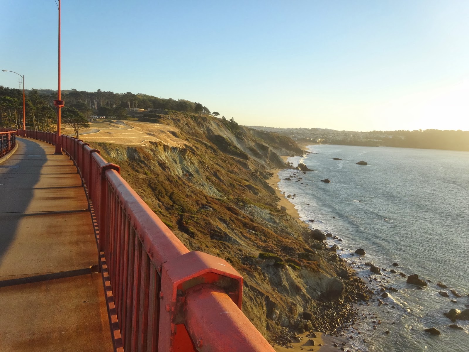
The road took me inland, through what looked like delta land until I got into a few good pulls, up mountains that were made of dry, brown grass, with a few trees, that reminded me of areas I rode through in Montana! After about an hour of riding, I stopped at a little general store in the town of Valley Ford for a breakfast sandwich. I knew that there was a good stretch before I hit civilization again, so it would also serve as lunch. It seemed like I climbed over the same mountains to get back towards the coast, after riding this little inland trip, which must have gone around some impassable coast land. Those climbs made me realize how fried my legs were, with the combination of relentless hills and extra weight in my panniers. Even though I did mountainous rides all summer, my two and a half week kidneys stone vacation in September pretty much wiped all that out. The legs were on fire when the Tamales Bay saved the day. As I ride along this bay for about nine miles of flatness, the wheels got their second wind. Tomalas Bay had homes stretched all along its shore, and seemed to be a big player in the oyster industry. It looked like a hidden gem for the folks of San Fransisco to get away to.
As I started climbing away from the bay, a pedestrian, trying to be friendly, saw me as a touring cyclist, and commented about how tough the next section was going to be. I gave him a sarcastic 'thanks for THAT news', and that is about when the Adventure Cyclist map took me off of Rt 1, and down, yes down, a side road towards a very mountainous looking region. I don't know what that guy was talking about, and I don't know what I missed, but this alternate route weaved through those mountains, and I never climbed one. I meandered along a creek or two, and my legs thanked God for ACA maps.
The maps led me onto a bike trail that took me through a redwood grove and Samuel Taylor State Park, a beautiful stretch of newly paved road with no traffic, that led through a couple of small towns after leaving the park. The road I was on was named Sir Walter Drake Blvd, and it took me through a pretty busy town called Fairfax. Traffic was out of control on the Blvd, but the ACA maps got me on some side roads, I just had a hard time following the detail of the map and finding all the streets. Some locals helped me, and I finally began a steep climb out of town. I climbed, and my miraculously cooperative quads held up, and as I crested the hill, I saw San Fransisco's skyline off in the distance. That was pretty cool! I flew down the hill and I was in the northern suburbs that include Sausalito. I was getting into thicker traffic when I was once again guided onto an all purpose trail that made its way through a delta area. As I rode off the path and into downtown Sausalito, I saw the Golden Gate Bridge, and the homes on the steep hillsides that I have seen on TV and in pictures. There was one more steep climb to get up to the Golden Gate, and it twisted through browned off mountains like I have been riding all day. I was motivated by the large amount of bikers that were flying all around me, and when I got to the bridge, there were bike trails and pedestrian trails that were segregated, so the bikers and pedestrians were both safe. We could cross the bridge on one sidewalk, and the walkers were over on the other side of traffic, a good system. The wind was blowing, the sun was getting low in the sky causing glare to the west, but the San Fransisco skyline was beautiful. There were sailboats in the bay, with Alcatraz in the distance. All I had to do was pay attention to the sidewalk so I didn't plow a tourist on a rent a bike, or get plowed by a serious rider who wanted to go 30 mph. Bike traffic wasn't as bad as I had heard it could be, but you had to be careful. The other side of the road brought the National Park visitors center, and all the tourists taking pictures. I went down to water level in the park areas, and headed toward downtown just about as five o'clock traffic was firing up. I rode on Bay Street past the Fishermans Wharf area and on to Embarkadero Street, right to the teeth of downtown. I followed a screaming green painted bike lane, but everyone was everywhere. It was like a video game. Go through downtown San Fransisco at rush hour and don't hit anything or get hit! I finally found a BART (Bay Area Rapid Transit) station underground on Market Street. After figuring out how to buy tickets, what level to go to underground (down two levels), what train to catch, what platform to stand on, get my heavy bike down an escalator with a million commuters, I finally stuffed my bike and myself onto a standing room only train. I actually got on the right one! It cost six bucks to take me to the end of the line, through Oakland and Berkeley, and to all places, Pittsburg (without the h). Pam, after an adventure of her own fighting traffic in the dark with no idea where she was going, picked me up at the BART station, and got me safely home to a campground near Lodi and Stockton.
I thought that maybe I would stay another night near Sausilito, and solve San Fransisco during a slower time of day, so Pam was surprised to hear from me a day early. There were no motels that wouldn't break me in that area, so I decided to do the whole thing. What an experience, but it would be invaluable knowledge during the next couple of days when Pam and I do our tourist thing.
 |
| Art work on bridge on back roads. Mountains that the ACA map took me around |
 |
| Trail going to Samuel Taylor State Park |
 |
| Litter or a place to kick back?! |
 |
| Coyote near the north suburbs |
 |
| Looking at San Francisco from Sausalito |
 |
| Homes on the hillside in Sausalito |
 |
| Bay Bridge over San Francisco Bay |
 |
| San Francisco is getting closer! |
 |
| First glimpse of Golden Gate, climbing hill in Sausalito |
 |
| Golden Gate Bridge |
 |
| Looking towards the town |
 |
| Bike trail |
 |
| Pedestrian lane |
 |
| Anti-suicide barbed wire |
 |
| Alcatraz! |
 |
| Green bike lane heading downtown |
At the same time Mike was having all the fun, I was moving from Willits to Flag City (just west of Lodi). I had 200 miles worth of fun driving through the mountains, along winding roads and then the joy of I-5 through Sacramento and its 4-6 lanes across!
 |
| Along I-5 there were many rice fields - after harvesting, they gathered all the dead stuff, piled it up and burned it! |


No comments:
Post a Comment