60.29 in 5:16......after two days of doing absolutely nothing exciting as the RV was getting repairs and maintenance, at the Monaco Headquarters, it was time to head on down the highway. I wanted to go back over to the Pacific coast, but I didn't want to go the way we came into Eugene, so I mapped out what I thought would be the path less traveled. I could have gone down the I-5 corridor (Pam went south on I-5), or I could follow a route that I found using the weather channel radar map. As it turns out, this area is quite a popular biking route, south of Eugene, but I didn't know it. I only saw one other biker, but a little lady at the Lorane General Store, who sold me fresh chocolate chip cookies at my half way point, told me she had many bikers a day as customers.
I started in warm and sunny (as sunny as it gets around here) weather, which lasted about five minutes. The sun soon buried itself behind thick cloud cover, and the temperatures tanked shortly thereafter. I started out in regular biking shorts and my regular type apparel. I rode about fifteen miles through Eugene, and out of town on Willamette Ave. As soon as I got out of town, I had a 1100 foot climb to over 1400 feet, at a 6-12% grade. That was an unwelcome surprise, and as I summited the hill, I was soaking wet with sweat, and the temperatures had dropped into the forties at that elevation. At the crest of the hill, I came across Bill's Bench (see pictures). I guess it was inspired by Pre's Rock, but it was a wooden bench put there in the early 90's, by a guy who wanted cyclists to have a place to rest after pounding the significant grade. So, I used Bills Bench to change into dry clothes that I was carrying, and to put on my long pants and foot protectors that I just bought. I'm glad I changed, because it saved a huge wind chill problem on the way down the adjoining downhill, and the temps stayed at about 51 until very near the end of my ride, where it topped out at 56. I followed a Fox Hollow Road, Lorane Highway, and Territorial Rd. through farmland and forest land for about 25 miles, and made friends with many of the animals I met along the way, including King Eeyore. I have pictures of them also!
After 25 miles of rolling hills on the above mentioned roads, I hooked up with Oregon Rt. 38, which is the thoroughfare to the Pacific coast. The traffic picked up significantly, but the shoulder is wide, and the terrain more level, so progress was quicker. I passed through the town of Drain, and onto Elkton, where Pam (who came across OR38 from I-5) had just settled in at the Elkton RV Park. It's a nice place with a great view of the Umpqua River, which I will more or less follow all the way to the coast.
 |
| This is Mary Decker Slaney, one of the great female runners. This huge picture is on a wall in Eugene. |
 |
| Autumn has arrived in Eugene, Oregon |
 |
| The plaque on Bill's Bench. |
 |
| Bike resting at Bill's Bench |
 |
| Rolling down the road. This could be a road in Pennsylvania |
 |
| Mike's friend, King Eeyore - he made up the name (Eeyore from Winnie the Pooh). I like the blue coat! |
 |
| Don't go Mike!! |
 |
| Friend #2 |
 |
| Today was the start of all the sheep farms. |
 |
| Mike just makes friends with everyone! |
 |
| This is where Mike got the fresh homemade chocolate chip cookies. |
 |
| This was in someones front yard. Not too sure about this..... |
 |
| Buddy's diner near the town of Roseburg! |
 |
| All the pretty trees in the nursery |
 |
| Just a cool view |
 |
| One of the many bridges in coastal Oregon |
 |
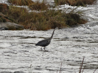
| The Umpqua River |


No comments:
Post a Comment