Mesa to Pitt 2015

Mesa to Pitt 2015
Mesa to OBX

Thursday, October 31, 2013

Day Two in Yosemite - October 24-25

October 24.....On the second day in the park, we didn't go into the valley, but got a different perspective..... Several viewpoints from 3000 feet above it. We came in on Rt. 140 again, but right before we entered the valley area, we made a right on Rt. 41 toward Glacier Point. In my opinion , if you only could go to one place in Yosemite, go to Glacier Point. But, there was plenty to see before we got there. As soon as we made the turn onto 41, we began a major climb. I had heard about the Tunnel View pull out, and it was spectacular, but just a preview of what was to come. There was road construction in the quarter mile long tunnel itself, so one lane was closed, and there was major congestion in the pull out. The view moved us so much that we attempted a 'selfie' photo with Half Dome in the background. I know I haven't mentioned it, but Yosemite has been my favorite place on earth since I visited in 1981. When I was here before, I was young and was more interested in jumping off a bridge into the Merced River. I didn't see anything like I saw today. After the tunnel view we lost the valley for a while, until we turned onto Glacier Point Road. After about fourteen more miles of climbing, past trail heads, forests, and meadows, our elevation had to be about 7000 ft. We stopped at the Sentinel Mountain Trails. We picked one, the Rock Fissure branch of the trail, so we figured we were going to see some big rocks with fissures in them. We walked over a mile, and what we saw was not what we expected. There some twenty something aged kids that were doing some slack lining 3000 ft over the valley floor. Slack lining is like tightrope walking, only the rope is not so tight. They were tethered to their line, and it's a good thing, because we watched two of them fall off, and WAIT TILL YOU SEE THE VIDEO! Nick Walenda has nothing on these kids. When Walenda walked over the Grand Canyon this summer, he had a twenty foot balancing pole to carry. These kids didn't walk as far, but they were as high, and used no poles. It was fun to watch, and it made us forget that we were looking DOWN on El Capitan, which was directly across the valley. Beautiful. We used our binoculars to look down on climbers, unlike yesterday, when we were looking up, way up, at them. We spent quite a bit of time out there watching, which would cause us to run out of daylight before we finished our day. Two miles further out the road, we came to Glacier Point. We could see even more, including huge waterfalls, and more of the Yosemite wilderness. This is one of the places on earth where I could put out a lawn chair, and just sit there and look. Thank God it wasn't overcrowded, because from the size of the parking area, I bet it gets crazy, with people walking all over each other. But, it wasn't, and the peacefulness was really nice.
 Then it was back out to Rt. 41 south, towards Wiwona, or the south entrance of Yosemite, and the Mariposa Sequoia Grove, where there are over 500 giant redwoods. We were too late to take the tram tour that they use to reduce congestion, but we walked over a quarter of the trail before we had to turn back because of darkness. The most unexpected sight here was the fire scars on almost all the trees, from a thousand years of forest fires. Some of the fallen trees were pretty charcoaled, even though sequoias are very fire resistant, and just don't die in fires like other trees. We left the park after our quick tour of the redwoods, and went out of the south exit on Rt 41 to go home a different way. We drove about 30 miles to the town of Oakhurst, where we ate at a very understaffed Denny's. Another hour or so on Rt49, and we were back at the KOA.
Checking out the fish in the Merced River


Merced River

We stopped to read a sign about Teddy Roosevelt and this raven sat next to our Jeep and begged for food!


El Capitan


Half Dome
Yeah, we look pretty bad in this picture!

Sitting in line, waiting to go through the tunnel


In the tunnel


Some of the forests show remains of old forest fires.  We never saw remains from this year's Rim Fire


Hiking the Sentinel Mountain trails


This bright green fungus/mold/moss was growing on alot of the trees.

On the trail

This young lady is slack lining

This guy on the really long slack line is getting ready to climb back on 

Looking down into the valley

Rock fissures

Not sure if this is white granite or marble - they are both in the area

View from Glacier Point

Half Dome up close


Glacier Point


Roots of an old redwood

Think it made a noise when it fell?!


Old, burned redwoods

Redwood tree


Grizzly Giant - had to take from far away so we could get it from top to bottom!  Biggest giant sequoia in the park

Black is old fire burns - the tree will start to heal itself.  It's trying to "cover" the burn

Back in the "old days" , they didn't think about hurting the trees when they carved tunnels thru them.


Slack lining in Yosemite!  We don't know this girl, but she was awesome!


View from Sentinel Dome Overlook


Friday, October 25. Pam woke up feeling lousy, but we had to move because the KOA was closing for the season. We spent some time adjusting one of our front mirrors because a guy in a fifth wheel from Georgia banged it the other day when he was pulling into his space. Thank God it didn't break, because you can't drive a rig like this in places like Sacramento on a busy road like I-5 without mirrors. It would have created major problems. But all was well, and I hopped on my bike for a one  hour workout while Pam drove about ten miles to the Mariposa County Fairgrounds. The day was beautiful, 82 degrees, no wind, lots of sun, but we laid low and let Pam try to regroup. We did check out the California Mining Museum which we were parked right next to, in the fairgrounds, and we went into the old town of Mariposa to have something to eat.

Our campsite at the Mariposa County Fairgrounds - they had 200 sites!!!

A nice day to relax and sun ourselves!


Wednesday, October 30, 2013

How to do Yosemite in two days- October 23

Day one, October 23. We drove 26 miles on Rt. 140 to the Archway entrance to Yosemite, on the west side of the park. The mountains became VERY big, and the road proceeded for about seven miles downhill, to the Merced River, which we followed, more or less, for nineteen miles upstream and/or uphill. I had entertained thoughts of riding to the park tomorrow, but they were quickly nixed, because of the sharp turns, lack of shoulders, and brutal final eight mile climb I would have had to make once I got up into the park. There was just no margin for error on the road, and it would have been a slow go. There was an archway tunnel just inside the park boundaries, which tour buses and motor homes could fit through, but it was a very tight squeeze. No one was bringing RVs of our size into the park itself. The scenery was beautiful, however as we followed the canyon formed by the river. The water level was very low due to the time of the season, but the water was crystal clear, and very, very cold. The huge boulders in the river were amazing, and were accentuated even more by the low water level. There were some deep 'holes', and they were really inviting to me, but a swim was out of the question. We did see some fish, and some of the mountain climbers used anchors to attach ropes to the big boulders so you could climb on the to jump off, if you were so inclined.
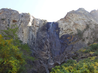
At one point, the Yosemite Valley finally opened up, and the first recognizable ( to me) thing we could see was El Capitan. Rising 3600 feet straight up from the valley floor, we could see climbers doing their thing on the face of the rock. There was a pull out, and we parked the Jeep, and took in the beauty and majesty of it all. When I said we watched climbers, it's not exactly how you probably pictured it in your mind. We used binoculars, powerful ones, and could still barely see them on the face of the rock. They were still smaller than ants, and it took some hunting to find them. It takes three days for them to climb El Capitan, and they sleep right on the ledges. We were told to come back at sunset and we could see their fires twinkling on the face of the mountain. We didn't do that, but it would have been cool to see. We took a half mile trail on the other side of the road and it took us to the foot of Bridalveil Falls. I was surprised to see that there was water flowing, because some of the falls,  (Yosemite Falls, one of the highest in the world) are dry right now. The area is also currently in a drought, which hadn't helped, either. I took some time and scrambled up the boulders to the base of the falls, something that is not always possible to do. The granite rocks on which I climbed were still worn slippery and smooth by the millions, if not billions, of people who have done the same climb. Speaking of the masses of people, (we were told that this place is ridiculously crowded in the summer), we feel lucky to be here this time of year, when it's not so crowded, and the leaves are changing. They are probably at their peak of color right now. I didn't have one Oriental ask me to take his picture, like I did in every other national park this summer. We spent the rest of the day walking trails around the Yosemite Village, and when we got slightly lost, we just hopped on a shuttle bus, and saw the rest of the valley by bus before it got too dark. It's getting dark earlier and earlier, which really takes time away from what you can do in a day. The sun set at about 6:10, and the shadows of the huge mountains cover the valley way before that. When the sun disappeared, the temps plummet into the 40s and 30s, so it becomes less fun to be walking on a trail somewhere. Yosemite is different from other national parks in that there are not many motor homes in the campgrounds, but mostly tents. There is also no huge lodge or hotels. There are hundreds of canvas tents  that you can rent, and there is also housekeeping camp. A huge area where you get a canvas structure with some wooden walls, but it is basically open air, to set up housekeeping. It looks as if parking is a huge problem in the summer. The pullouts on the road were busy for us, so I imagine the whole place is a zoo in season, unlike when I was here in the early eighties. Most people tell us that 75-80% of the tourists are foreigners. We saw the valley in one day, and tomorrow will be above the valley.

On our way to Yosemite!  The road was blocked due to a rock slide, so they built this one lane bridge to route you to the other side of the river and then another brings you back to the other side.  Vehicles longer than 42' are banned, and motor homes must disconnect their towed vehicles.  And Mike wonders why I didn't want to drive the MH here!  Really?!

Since the bridge is one lane, you have to sit and wait about 15 minutes until the light changes and gives you the green light.  While we were sitting, Mike took a picture of where we came from.

Starting across the bridge

Looking across the river at the rock slide - behind the sign is where the road comes out of the slide.


Autumn is here!


Looking down at the Merced River

Just inside the park is this rock tunnel that I can't figure out how buses and RVs fit through!

El Capitan!  Looking for climbers on the rock face.
Autumn leaves on the creek

Bridalveil Falls


The wind would blow and made the water shift back and forth like a veil in the breeze!

Mike crawling back up from the foot of the falls


Merced River

Autumn in Yosemite

Sentinel Mountain

View from visitor's center

Tepee at the visitor's center

Trail trough the woods

Dry creek bed - not like this in the spring!

Yosemite Falls info - but no water today!!!

Famous Half Dome


In 1997, Yosemite was flooded by a quick snow melt and stalled rain system.  Mike is standing by the road - the flood waters would have been over his head!  There are "new" bridges all through the park!

Half Dome from a bridge over the Merced

Mike's reflection picture!

El Capitan from the other side

Climber on El Capitan

We hiked a trail that was below the back side of El Capitan - this was looking up from the trail.


Enjoy this video of the Bridalveil Falls!  Mike climbed to the foot of the falls to take this panoramic video.