Mesa to Pitt 2015

Mesa to Pitt 2015
Mesa to OBX

Monday, April 25, 2016

April 25, 2016../.North Little Rock, AR to Forrest City, AR

96.61 miles in about 7:48 (about 12.4 mph) total trip miles 1543.03 in 20 days for an average of 77.15 miles per day.....ascent 428 ft .....trip total 29,157 ft.
I had a lot of time to think today, so here are some numbers I thought about. I'm really into statistics and numbers. If I hadn't spent that day in El Paso playing around( I only went across town and rode 22.51 miles), I'd be averaging over 80 miles a day.
I decided to compare my numbers to the trip from Phoenix last year after 20 days, and the numbers are very similar. Last year after 20 days, I had ridden 1496 miles, only 47 less miles than this year. I had climbed 32002 ft (29157 ft this year). I thought it was a flatter course. And last year I was averaging 74.8 miles a day, about 2.5 miles a day less than this year. Pretty similar numbers, and interesting to me. ( I'm glad I'm doing a little more this year, because I'm competitive with myself like that).
Even though I hate to admit it, I'm feeling a little beat up. I don't like to show weakness, but damn. ...the bottom of my feet have spots from my clips, my knee injury from softball is firing up, even though I know how to massage it to loosen it up, I'm getting tingles in my left shoulder blade, and my wrists are sore.....but damn..  I'm 60 freaking years old, and even if I was 30, some little things would be starting to show up, so.....I'm good. Maybe it'll rain soon and I'll get an easy day!
I counted my rollers again today.....zero....it was flat as could be .. The wind was helpful for the most part, and it was overcast all day. I started in North Little Rock, with about 8 miles of industrial area, then I was into a bayou ( where Luscious Clay hid his money). How well do you know your Charlie Daniels?? Anyhow, I was accompanied by delta  and bayou water for most if the day . The bayou reminded me of the Everglades a little, then it was gone in eight miles or so. Farm land was the predominant feature, with large amounts of unflooded, and maybe unplanted rice patties. Cotton, corn, and soy bean crops were also in various stages of preparation. There were many fish hatcheries and minnow farms along the way also, most run by Arkansas fish and game. There were once again several small farming towns, and I crossed the White River and the Cache River. I stopped and had a catfish sandwich for lunch in a little town. I was on US 70 (the same one that used to go through Mesa, Az),all  of the way today, but we were never far from I 40. After the first 37 miles my BEEhind was really beat up with frost heaves, as US 70 was not in the greatest of shape, and the wind wasn't totally cooperating. At that 37 mile mark, the road changed to nice smooth pavement, and all was well again. The nice surface made a difference of at least a mile an hour. The wind, which was supposed to get stronger as the day went on, either faded, or was on my tail.
This was definitely an area that I needed to get through on a nice day, because it was wide open, and the wind could have been brutal in another day. Storms are brewing, and I'm glad I'm through that wide open stretch. As I got near my destination, there was another bayou, which went about 8 miles, with no shoulder, but the trees protected me from the wind. I ate Chinese in Forrest City, and discovered that there is no way for a biker to cross the Mississippi between West Memphis, AR, and Memphis, Tennessee, so I've gotta go 40 miles south, into Mississippi tomorrow, so a potentially easier day tomorrow becomes, another century. Oh well.

The bayou just outside of North Little Rock

Shoulder less roads were common in US 70

When was the last time you saw an Esso sign?

Grain mills were a common sight.  This was the biggest


An old train bridge on the White River

The White River

A selfie while riding with farm equipment bearing down on me!

An appropriate name in Arkansas Razorback country!

I don't know what this white field was, but it was impressive!

Sunday, April 24, 2016

April 24 - Arkadelphia, Arkansas, to North Little Rock, Arkansas


82.0 miles in about 7:17....(1446.42 total miles over 19 days.....averaging 76.127 a day)
Ascent....2589 ft....28729 ft for the trip...
When I rolled out if town at 8:30, I realized that Arkadelphia, as well as the town I was in before that, are pretty much built on a hill. Most of the time towns are built in a valley, by a river, or water source, and the first thing I do in the morning is climb out of the valley. Here, in the Arkansas Delta country, the town's are built on a hill, and the first thing I did was go down in elevation. Actually, there were a few rollers past two universities that I hadn't heard of ...Henderson State U, and Ouachita Baptist U. I guess I was riding today in the foothills of the Ouachita Mountains, which are in northwest Arkansas and Oklahoma. I always talk about the 'rollers', but u never really know how many hills I climbed in a day. Today I decided to count them.
It turns out that I'm glad I did. Today was my third highest elevation climb of the trip, over 2500 ft, and I counted 40 hills that I had to gear down to my easiest gear. This particular course that I have taken from Phoenix, is no doubt, the flattest way that a person could get to the Mississippi River. Other rides have climbed 4,5,6000 ft in one day. I only have had one day over 4000. You won't get that by going north out of Phoenix!!
My first 40 miles were once again on US 67, but in Benton, 67 went off to Hot Springs, and
I was left at the mercy of the GPS.
Somewhere out there, I had a crazy incident that I want to mention. There have been lots of dogs in Arkansas, but most of them chase me for a while, then let me alone. I haven't had to pull my weapon but once, and I didn't need to that time either. Well, today a dog was running along side me, and I was focused on it, of course, when the dog spooked a squirrel out of the high grass along the road. The squirrel shot out in front of me, and I swear my front tire just missed it by inches. I almost ran over a damn squirrel!!! I wonder how that would have turned out if I hit it and wrecked with the dog hot on my heels!!
Surprisingly, once I got to Benton, I was only half way into my trip, but I think I was in some one's city limits all the way for the next 40 miles to the Motel. I think I may have been in the city of Bryant also. There were absolutely no shoulders on roads, and very few bike lanes for that last leg of the journey. I rode through lots of residential areas, but I was also on some skinny roads that had twists and turns, and peaks and valleys, that I should not have been on. People around here are NOT used to bicyclist, but many erred on the side of caution, and did not know how to pass me. That is just as annoying as the guys who blaze by me recklessly. It was a little crazy in spots.
I was cruising along in one of the neighborhoods, when suddenly I came upon the campus of the Arkansas Children's Hospital. Just as quickly I rode right past the state capital building, then right through downtown, which has some pretty tall buildings, then across the surprisingly big Arkansas River on a bridge with no bike lane. It was very fortuitous that I was there at five o'clock on a Sunday, not on a weekday with all the traffic.
Once I got to the Motel 6, which was pretty beat up, I could not find a restaurant that was open, so I ended buying some hamburger buns and some turkey Bologna at the save a lot.

A beautiful mural in downtown Benton.  First the whole thing, then the close-ups.


The Arkansas state flag

What if people can't read???  Uh oh!

No shoulder, sharp turns, nasty roads going into Little Rock

I came to this sign a full 20 miles before I found my motel in North Little Rock

I wonder why Mickey and Minnie are black???

The Arkansas state capital building

I was right in downtown, on a Sunday with no traffic, fortunately

The bridge over the Arkansas River, with no traffic!

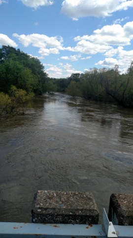
The Arkansas River is huge, even when it's not high, like all the rivers I've seen for a week.

I stumbled across a minor league baseball game, the Arkansas Travelers.

April 23 - Texarkana,TX to Arkadelphia, Arkansas

April 23...//85.76 miles in about 7:05....(1364.42 miles for trip in 18 days.... 75.8 miles per day)....ascent... 1302 ft....trip total 26140....
I started  out my day in the Arklatex tri state area. In Texas, one mile from Arkansas, and about 30 miles from Louisiana. I took my time getting out of town as I went a little out of my way to find the post office and county courthouse for some pictures. As I headed out of town I realized that I was finally done with Texas chip seal. The road, US 67 that I would be on all day again, was sweet, smooth, asphalt. The first 13 miles out of town was a brand new shoulder, and the entire length of the trip was just in really good shape. The entire ride was just as nice as a ride can be. Perfect temperature, calm winds, puffy white clouds, very gentle rollers or totally flat.... Riding US 67 reminded me of US 40 last year, close enough to the interstate that I had only local traffic, and small towns along the way. Since it was Saturday, there were no work trucks. Judging by the bark along the side if the road, I picked up right away that there is some serious logging industry in the area. There were huge pines in the area that reminded me of riding through the Carolinas. That proved to be true later on as I came upon a huge Georgia Pacific wood products plant.
I got about 30 miles out of town when I realized I left my older pair of biking gloves in the Motel. Pissed me off. I have also left a bottle of Shampoo and a wall charger for my phone and Garmin. I hope I don't leave anything else.
I was surprised at the very low elevation of this area. I spent most of the day 2-300 ft above sea level. I have been gradually descending since rolling off the cap rock in Lamesa, Texas, from over 3000 ft to this. Now there is really no place to go but up. I started noticing the swampy or possibly bayou areas yesterday, but today I was in sight of water for a majority of the day. I crossed the Red River, which was running high because of heavy rain in Oklahoma a few days ago, and the Little Missouri River, which wasn't as high.
About 20 miles into my ride, a guy in a black pickup threw a can of diet Coke at me and hit me in the shoulder. That's only the second time that has happened in all the miles that I have ridden. I got it in the back with a bottle of mountain dew in North Carolina a few years back. U will have that in redneck areas, and Arkansas qualifies as that. A few miles down the road, in a town called Preston, the good side of Arkansas came through. I stopped in a little convenience store, and the guy gave me two free Polish sausage sandwiches because he had never met anyone doing what I'm doing. That's been a difference in coming this way, as opposed to the common routes I've taken in the past. People here have never seen the likes of me before! As I was eating my sausages, I sat with an older guy who filled me in in the local area, and chatted with a bunch of kids on bicycles. I love trying to understand the dialect of people in this area. Sometimes it's like a different language.
I rolled into Arkadelphia, eventually, to be greeted by a train, my fifth one of the day, as I was usually within sight of train tracks. I believe I am also still seeing remnants of the Bankhead Highway. I found a no tell motel in the middle of town, then found an 'island bar' and had the catfish and a beer or two, before proceeding to the Sonic for a half-price milkshake.

A new state that I've never ridden in.  I'd have to look it up but I think that makes 32 states!

The only courthouse and post office to be in two different states

Redneck country!

The road to Nashville

Brand new shoulder on US 67 greeted me to Arkansas.  No more chip seal!!!

The fields were alive with this yellow bloom

The Red River above flood stage

Lots of low lying swamp areas

Mr Larry Fisher, my lunch companion

Lots of trucks selling mudbugs on a Saturday afternoon

Georgia Pacific's logging storage.  No trucks today though!

Lots of Confederate flags for such a diverse population

Train and a grain mill in Arkadelphia

Town square in Arkadelphia

The "island bar" in Arkadelphia

The bike is in two different states!

Downtown Preston, Arkansas

Saturday, April 23, 2016

April 22 - Sulphur Springs, TX to Texarkana, TX

101.22 miles in 8:24...(total trip miles, 1278.66...17 days at 75.21 miles per day) ascent.....2162 ft.. .trip total 24,838 ft.....A full 40% of my ride has been in Texas, 513.66 miles, and that's just since I was last in New Mexico.I was in Texas for a while from El Paso to almost Carlsbad also. I'm ready to move on. Could it be that I've ridden on my last Texas chip seal? I've never been to Arkansas, so we'll see. It took six days to cross Texas since I last was in New Mexico, and I was in Texas for quite a while before that.
Now for today's century ride. The weather was absolutely perfect. Why couldn't every day be like today???? After riding about ten miles on I-30 frontage road, which doubled as US 67, I broke away from the interstate. Contrary to GPS girl's recommendation, I spent the entire ride on US 67. It continued to parallel the historic Bankhead Highway, and I could see the old road and old bridges in many places. I thought it was going to be a nice, quiet ride. I even saw a fox cross the road in front of me. Then things picked up. US 67 reminded me very much of riding US 40 last year. Local traffic, many small towns, and decent road. Two lane road took me into Mt. Vernon after about 20 miles, and another 20 miles took me into Mt Pleasant, with several small towns with population of about 1000 dotting the map in between. Towns like Naples and Omaha each had one strip of buildings that served as there downtown area.
The road was just loaded with mild rollers, and on the second half of the ride, I crossed four dike type areas, with swampy areas that held a lot of water. The land between My Pleasant and Texarkana was the lowest in elevation I have been on yet, and it showed with lots of lakes and swampy areas. The Sulphur River is one that I've never heard of, but it was high, muddy, and flowing pretty good. Other areas were full of water, but they were their normal tea colored water.
One thing I noticed that was different, was how much time I spent riding in the shade of huge trees. They were oak as well as other species, but I haven't seen trees over their size anywhere on my route. There were an abundance of dead turtles on the road, probably because of the high water. 
For the second time in two days, I was chased by a three legged dog. I almost felt bad for them, but I cheered them on as I rode just a little faster than they could go. There were quite a few dogs in the small towns, and I had the lock off of my weapon (bear spray), but I didn't have the need for it.
I did the first 50 miles of the ride in 4:09, and the second 50 in 4:08, so I was happy with the negative split.
Once I pulled into the Motel 6, and drug my bike up to the second floor, I ate and had a beer at an Applebee's, where I had a small amount of celebrity status, as the bartender spread my story, and people responded with free drinks. Not many cross country riders do this route, as none of them had met a bike tourer before me. Cheers.

The Sulphur River was pretty high

I was happy to see Texarkana.  I'm officially in the Arklatex area!  30 miles from Louisiana, 3 miles from Arkansas and STILL in Texas!!

Thursday, April 21, 2016

April 21 - Plano, TX to Sulphur Springs, TX

78.87 miles in 6:30....(1177.44 miles for the trip in 16 days.... Averaging 73.59 per day) ascent.... 1293 ft (22676 ft for trip)
The forecasted rain and gloominess never really materialized, as all the bad stuff hit to the west, in area I've already passed through. The roads were a little wet, and the temps were in the mid 60's, and the clouds gradually went from total overcast, to white and puffy, to almost total sunshine and 80 by the end of the ride.
The first 25 miles if the ride were still in what consider metro DFW, as I rode on main roads and industrial parks. One three mile stretch was under construction and particularly hairy with both directions of traffic on one narrow two lane.
The next 20 or so miles were through farm and ranch land, dotted with cornfields and small towns of between 500 and 1500 people, on County roads and state roads, in various states of chip seal. I didn't even mind the rough chip seal so much, because the weather, wind direction, and general aura of the ride was just.....nice. It turned out to be a great day. Legs were good, rollers were very gentle, traffic mild, once I got out of the big city. The landscape was very green, and the grasses were all going to seed, which means by the end, my eyes were itchy and red. GPS girl took me on some really bad roads as I backed into Greenville, a town of about 15000, but I never really saw much, because she kept me out in the woods, which bicycle GPS has a tendency to do. I would have rather ridden through town, to check it out.
The next 25 miles into Sulphur Springs was on Interstate 30 frontage road, through otherwise unremarkable terrain.
Since I missed Greenville, I took the business route through Sulphur Springs. I'm glad I did. As I was coming into town, a police escorted parade of very old cars headed out. They were on a tour, celebrating the Bankhead Highway that I mentioned in a previous post. It is an original transcontinental route that ran from Washington DC to San Diego. The business district was also a pleasant surprise, with brick streets, music piped on the street, and outdoor cafés and shops filled with people. The town square, that is so common in the Midwest, had dancing waters and a red granite courthouse. As I was snapping pictures, the city manager walked up to me and we chatted for a while. Five miles later I was at a Day's Inn next to I 30. I soaked my legs in a very cold outdoor pool, ordered Domino's, and chilled out.
Now for an editorial comment: Since I'm almost all the way through Texas, with the wealth, and God, country, and family mentality that I've seen, I understand the quiet movement I have heard about. Some people here want Texas to secede from the Union and form their own country. I heard about it last time I was here, and saw bumper stickers again this time. With the way the USA is headed right now, maybe they could do okay. I have noticed the ten commandments posted in a lot of city properties, and nobody seems to be suing to have them removed. Save us, Texas!! And maybe get rid of the damn chip seal.

A suburb of Dallas. I wonder if their nickname is the coyotes?  That would make them the Wylie Coyotes!

More wildflowers along the road

Century tomorrow?  Yep

Bankhead Highway parade of old cars in Sulphur Springs


Town square in Sulphur Springs

Downtown Sulphur Springs